Henry's Route to Agincourt, 8-29 October 1415
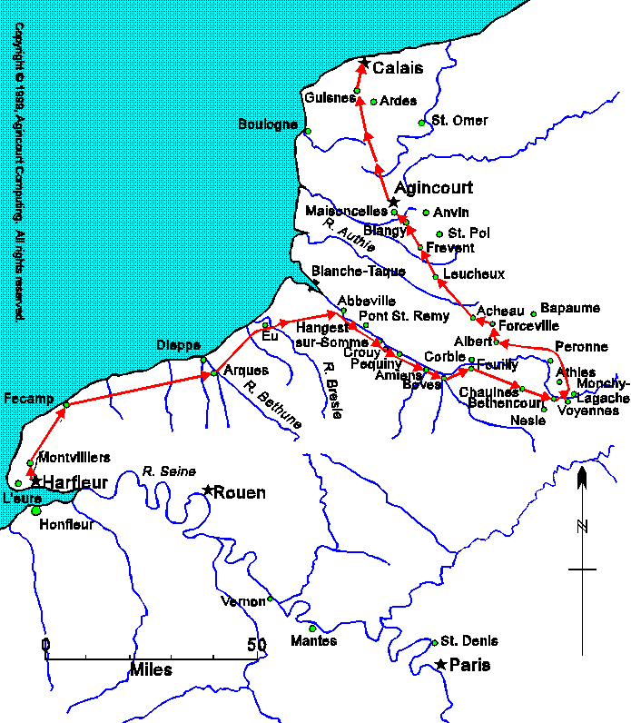
The red arrows show Henry's march. Each arrow is one day's travel.
The red arrows show Henry's march. Each arrow is one day's travel.
The French forces on the east bank of the Somme simply paced Henry, until he was finally able to get ahead of them by cutting off the loop of the river between Fouilly and Nesle.
 Back to the Description of the Battle
Copyright © 1999, Agincourt Computing.
All rights reserved. See the legal stuff for details.
Last updated